You’re two days into a bikepacking route, cell service dropped off 30 miles back, and you need to figure out which fork in the trail leads to water. This is when your navigation app choice actually matters — not while you’re planning the trip on the couch, but standing at an unmarked junction with zero signal and a phone sitting at 40%.
This article includes affiliate links. We may earn a commission at no extra cost to you.
Most cycling app reviews are written by road cyclists who never lose cell coverage. Bikepacking is a different animal. Your app needs to function completely offline, handle GPX file imports without drama, and not murder your phone battery by noon.
What Bikepacking Navigation Needs That Road Cycling Apps Don’t
Garmin Connect, Wahoo, Strava — all of them assume you have data service. Bikepacking doesn’t. Four requirements separate a genuinely usable bikepacking nav app from a road cycling app that happens to show trails:
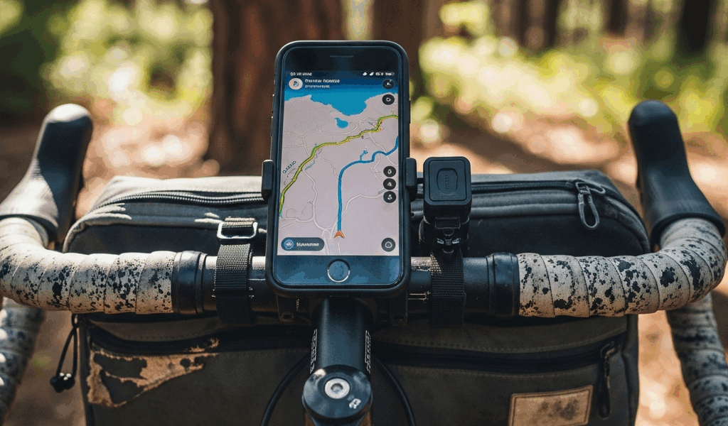
Offline maps that actually function. Not cached tiles that go blank after a few days. Not “download this region and cross your fingers.” Full routable offline maps that let you search, reroute, and navigate with zero data connection.
GPX/TCX import. Bikepacking routes get shared as GPX files — someone rode it, recorded it, posted the file. Your app needs to pull that file in and display it cleanly on the map. If importing a GPX requires a premium tier or some convoluted desktop-to-phone workaround, that’s a problem.
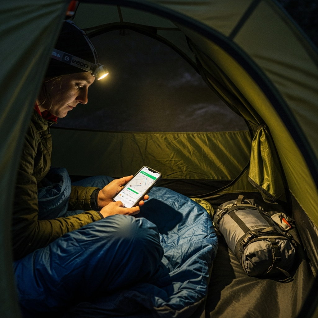
Battery efficiency. GPS running all day eats phone battery fast. Some apps are dramatically worse than others. Your phone on a bikepacking trip is also your camera, your emergency communication device, and possibly your camp entertainment. An app that flatlines the battery by 2pm is a genuine safety concern, not just an inconvenience.
Topographic detail. Gravel and dirt routes need real elevation data and surface type info. A road map showing “unnamed road” where you need “steep doubletrack, 15% grade” isn’t just unhelpful — it’ll put you on the wrong trail entirely.
Komoot vs Ride with GPS vs Gaia GPS
These three are what serious bikepackers actually run. Everything else is either a road app pretending it works offroad or an outdoor app that handles cycling routes poorly.
Komoot wins if you want planning and navigation together in one place. It has a Strava-like community, surface type data showing what terrain each segment covers, and offline region downloads running $4–30 per region. The planning tools are solid — drag your route across trails and Komoot estimates surface types and difficulty as you go. The downside: offline coverage is region-based purchases, not route-based. A coast-to-coast ride might require 8–10 separate region buys.
Ride with GPS wins when you’re following someone else’s published route. Route import and management are the strongest of the three — organize routes into collections, pin notes to waypoints, and the turn-by-turn cues are dependable. Offline maps need the premium plan ($80/year), but the download is smart: it grabs a corridor around your specific route rather than making you buy entire regions. Battery efficiency is also the best here.
Gaia GPS wins when you need real topographic depth. USGS topo layers, OpenCycleMap, satellite imagery — nothing else touches the map variety. If you’re threading through remote backcountry where trails aren’t well-marked, Gaia’s detail will bail you out. The trade-off is real, though: route planning is weak next to Komoot, and battery drain is the worst of the three. It’s an outdoor maps app that cyclists borrow, not a cycling app.
How to Set Up Offline Maps Before You Leave
This part is non-negotiable. Download your offline maps on Wi-Fi the night before you leave. Not at the trailhead where you have one bar. Not “once you get to camp.” The night before, at home, phone plugged in, no rush.
Komoot: Buy and download region packages for every area your route crosses. Double-check region boundaries — routes have a way of clipping the corner of an adjacent region, and that corner will show blank map tiles unless you’ve purchased it.
Ride with GPS: Open your imported route, hit the offline/download option, and pick your corridor width. A wider corridor means a bigger download but better coverage if you need to detour. You’ll need the premium plan for this feature.
Gaia GPS: Pan to your route area, select which layers you want offline (USGS topo is the must-have), and download at the highest zoom you’ll actually use. Multi-day routes can be 500MB+ downloads, so start early.
After everything downloads, test it. Flip to airplane mode and check that your route loads, the map renders clearly at riding zoom, and search still works. Better to discover a gap at home than at mile 40 with no signal and a fork in the trail.
The Verdict: Which App for Which Bikepacking Style
Following a published GPX on a self-supported multi-day route: Ride with GPS. Strongest route import, lightest battery hit, reliable turn-by-turn. The $80/year premium pays for itself on the first trip through offline maps alone.
Planning and riding your own route: Komoot. The planning tools and surface type data make it the best single-app solution. Grab the region bundle if you ride in one area regularly.
Remote backcountry with real navigation challenges: Gaia GPS paired with Ride with GPS. Gaia for topo maps and terrain reading, Ride with GPS for turn-by-turn route following. Two apps doing two different jobs.
Budget setup: Komoot’s free tier includes route planning. Add individual offline regions at $4 each for your route area. Covers most bikepacking navigation needs without a subscription.
One last thought: if your trip runs longer than three days, a dedicated Garmin GPS device (Edge Explore or similar) is genuinely worth the money. Managing phone battery across a multi-day bikepacking route is a real logistical headache, and handing navigation off to a device with 15+ hours of battery life solves the problem cleanly.


Stay in the loop
Get the latest adventure cycling world updates delivered to your inbox.